Portfolio
Research projects, software tools, and consultancy work spanning academia and the private sector.
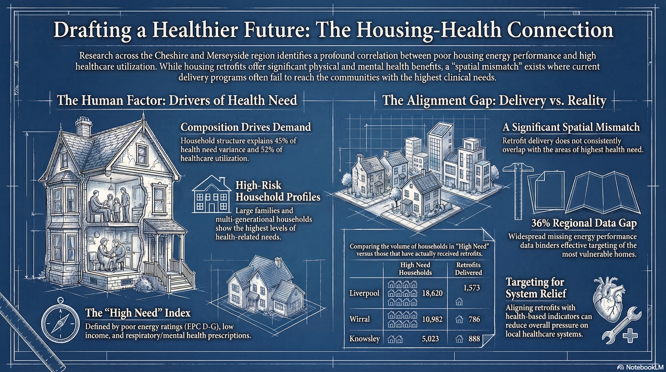
Network Data Lab - Topic 6: Housing and Health
AcademiaUniversity of Liverpool · 2022–2025
Linked NHS primary and secondary care data to 1 million households across Cheshire & Merseyside to analyse how housing composition, energy efficiency, and retrofit delivery relate to health needs and service utilisation.
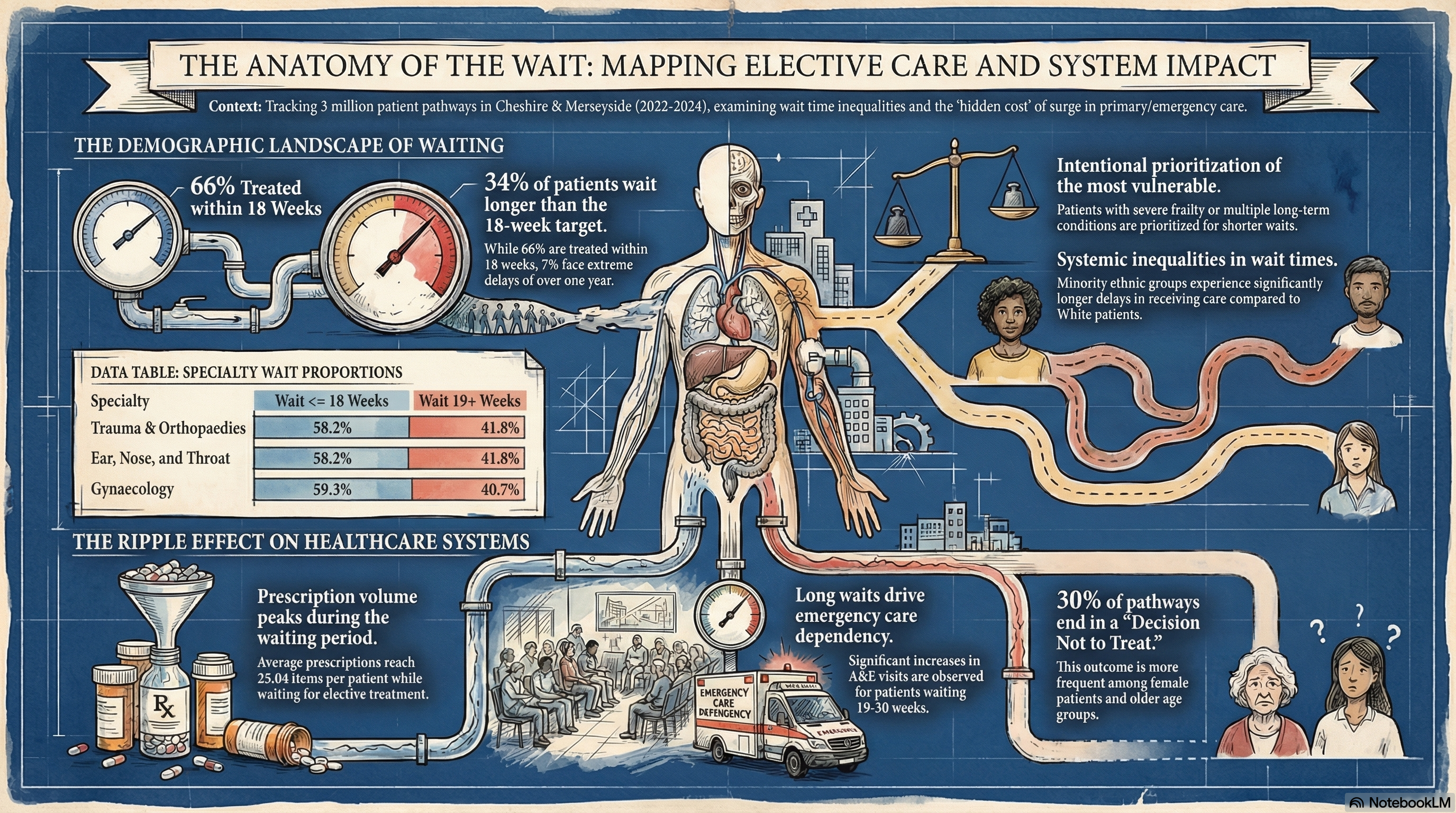
Network Data Lab - Topic 5: Waiting Lists
AcademiaUniversity of Liverpool · 2022–2025
Linked NHS elective waiting list data to primary and secondary care records for 3 million patients across Cheshire & Merseyside to analyse inequalities in wait times and the impact of longer waits on healthcare utilisation and costs.
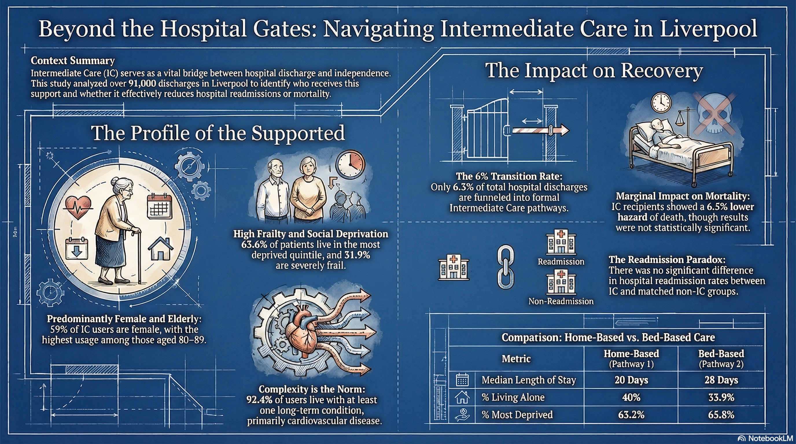
Network Data Lab - Topic 4: Intermediate Care
AcademiaUniversity of Liverpool · 2021–2024
Linked NHS secondary, community, and social care datasets to analyse the characteristics and outcomes of patients discharged into intermediate care pathways across Liverpool.
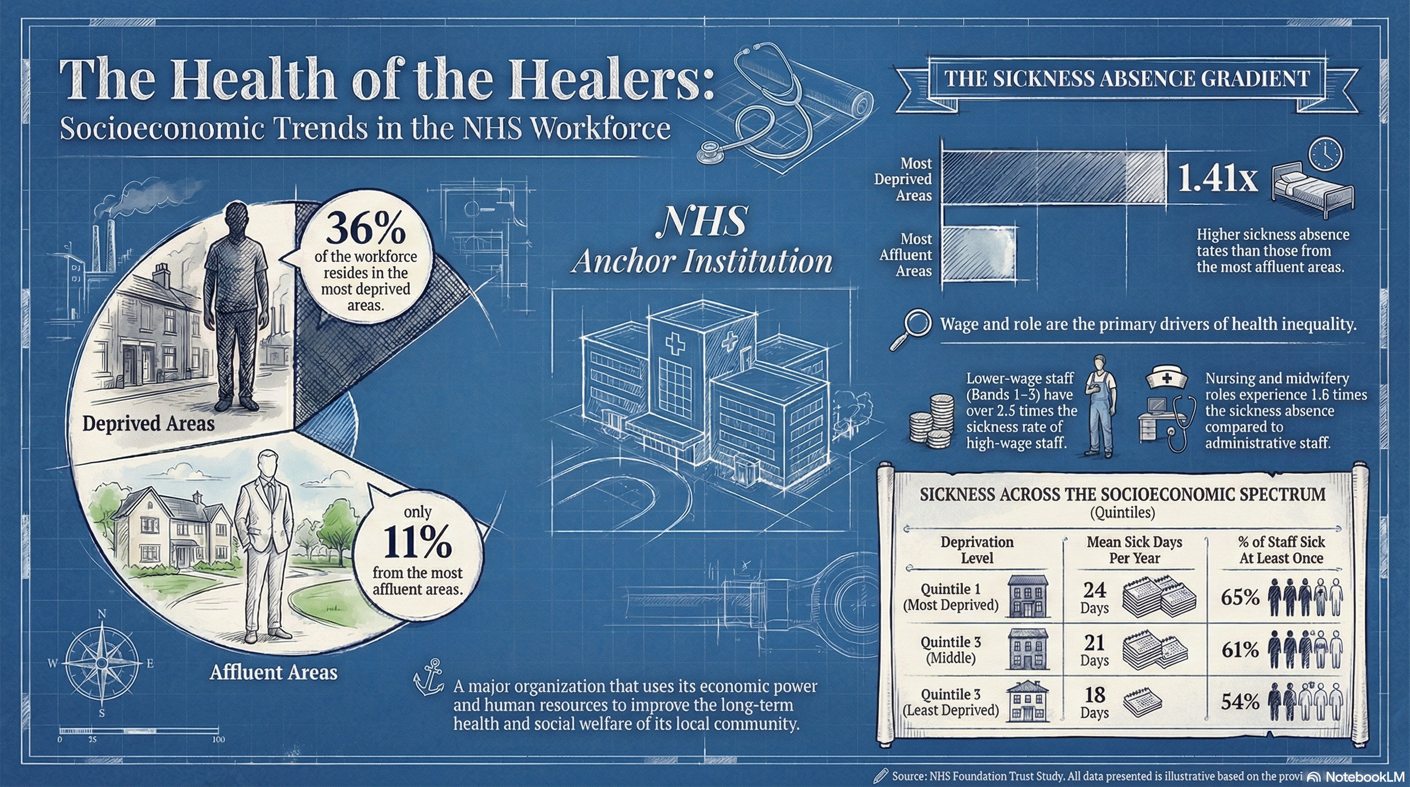
Socioeconomic Inequalities in NHS Recruitment and Sickness Absence
AcademiaUniversity of Liverpool / Mersey Care NHS Foundation Trust · 2021-2022
Cross-sectional analysis of electronic staff records showing that NHS employees from deprived areas face significantly higher sickness absence rates, driven by wage band and occupational group.
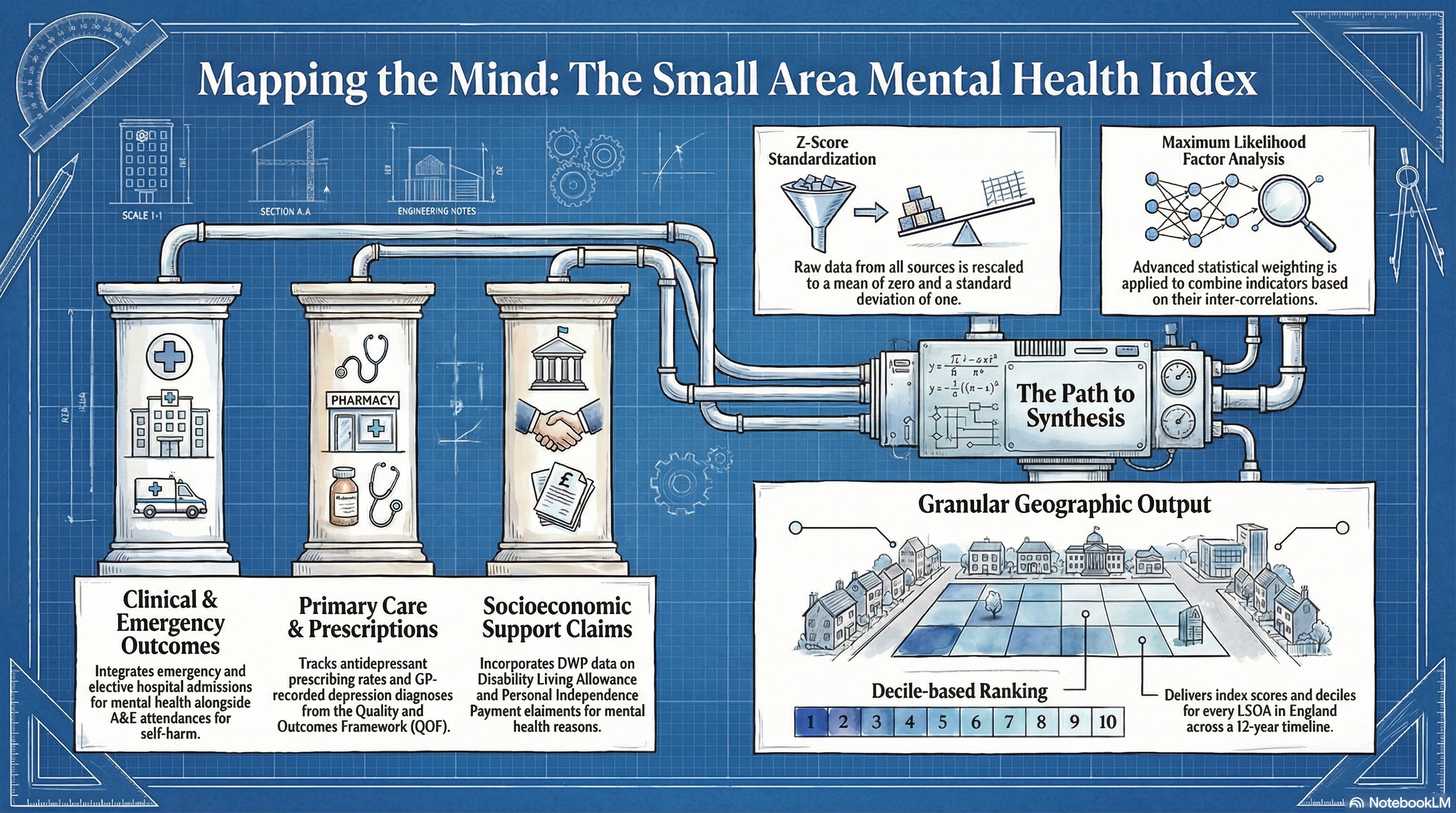
Small Area Mental Health Index (SAMHI)
AcademiaUniversity of Liverpool · 2011-2022
Annual composite index of population mental health for every LSOA in England (2011-2022), derived from four NHS and DWP administrative data sources.
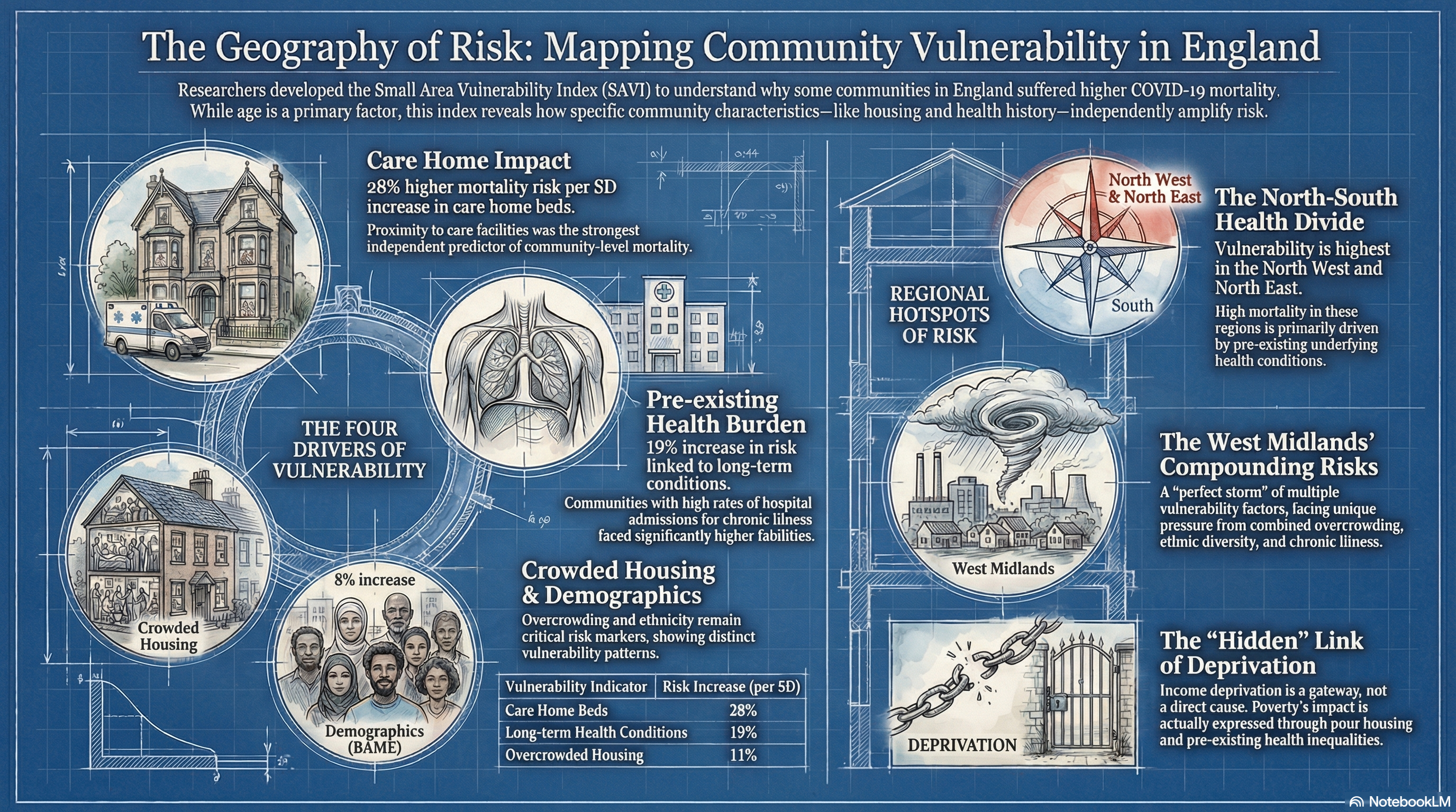
Small Area Vulnerability Index for COVID-19
AcademiaUniversity of Liverpool · 2020–2021
Developed SAVI - an empirically derived index mapping COVID-19 vulnerability across 6,789 small areas in England to inform pandemic response and resource allocation.
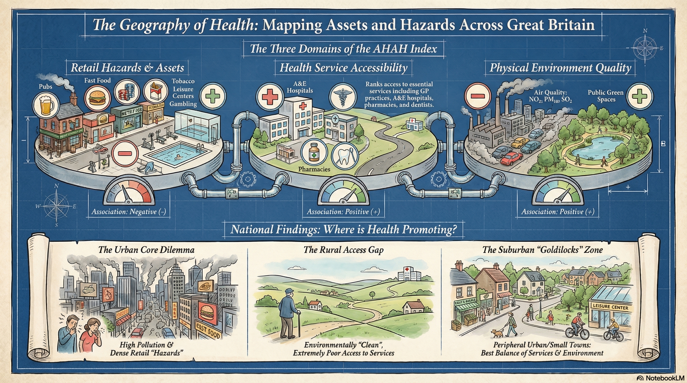
Access to Healthy Assets and Hazards (AHAH) Index
AcademiaUniversity of Liverpool · 2018-2019
Open dataset and composite index measuring postcode-level accessibility to 14 health-related features across Great Britain, covering retail, health services, and the physical environment.
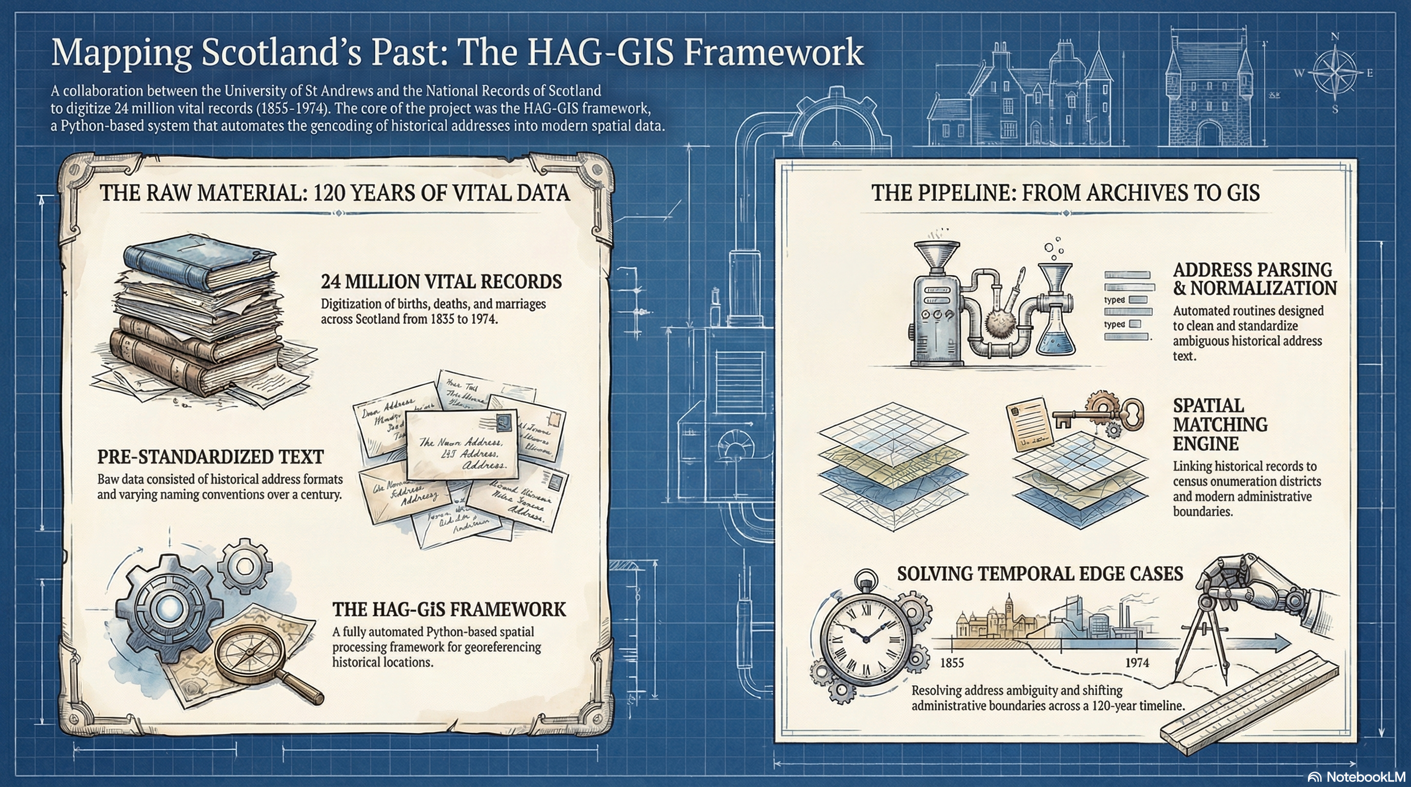
Digitising Scotland
AcademiaUniversity of St Andrews / National Records of Scotland · 2014–2016
Automated spatial framework for geocoding 24 million historical Scottish vital event records from 1855 to 1974.
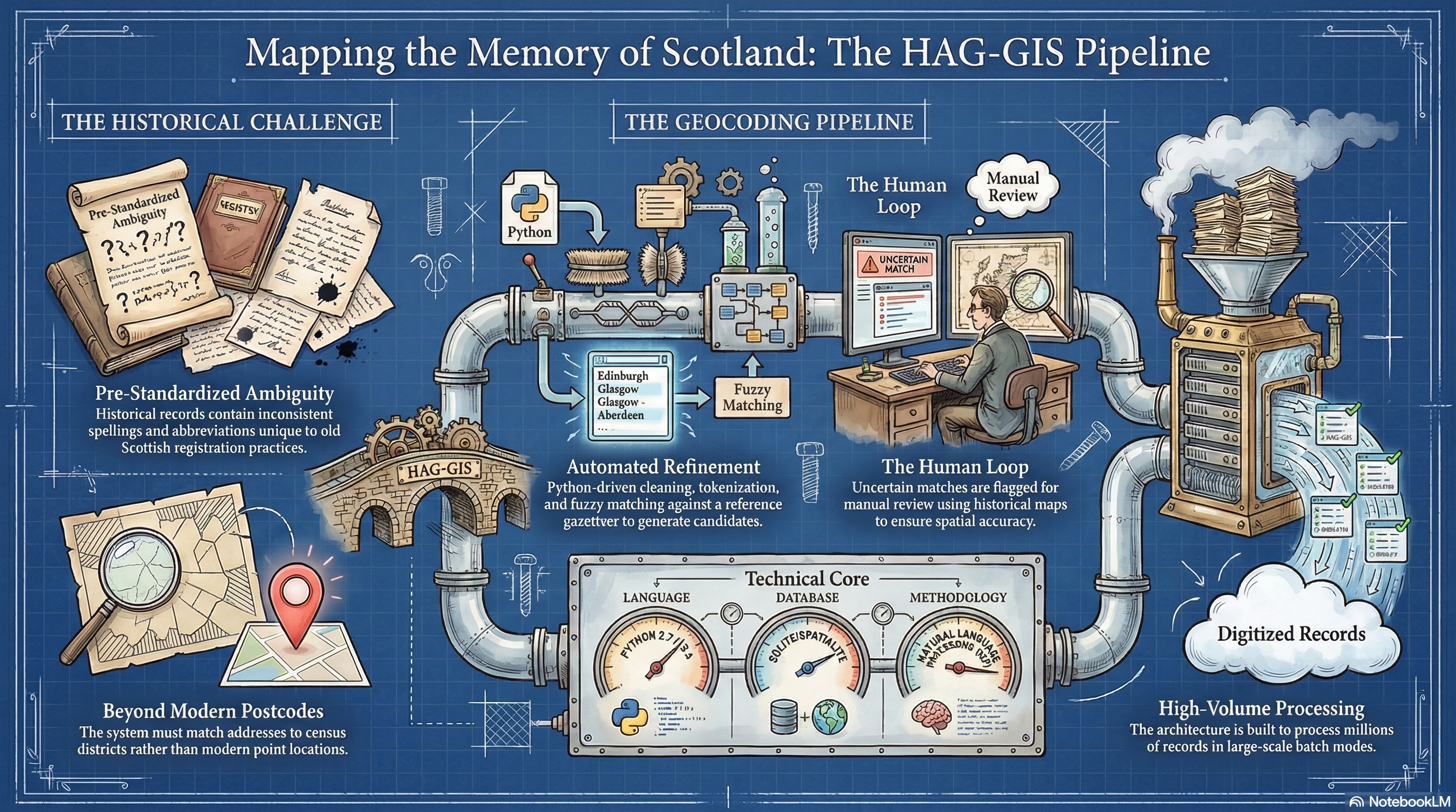
HAG-GIS
OtherDigitising Scotland / University of St Andrews · 2014–2016
Historical Address Geocoder — an open-source Python tool for automated geocoding of 24 million pre-standardised historical Scottish addresses (1855–1974).

IMAGE Project
AcademiaUniversity of Leeds · 2012–2014
Investigating how internal migration varies between countries around the world. Developed the IMAGE Studio analytical software for cross-national migration analysis.
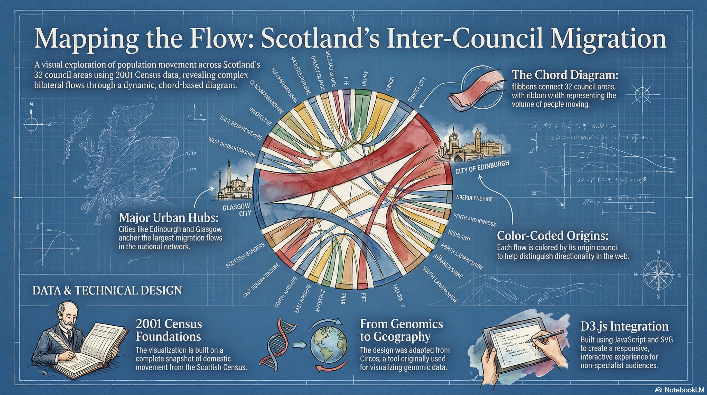
Scottish Internal Migration 2001
OtherUniversity of Leeds / IMAGE Project · 2013
Interactive D3.js Circos-style diagram visualising inter-council migration flows from the 2001 Scottish Census.
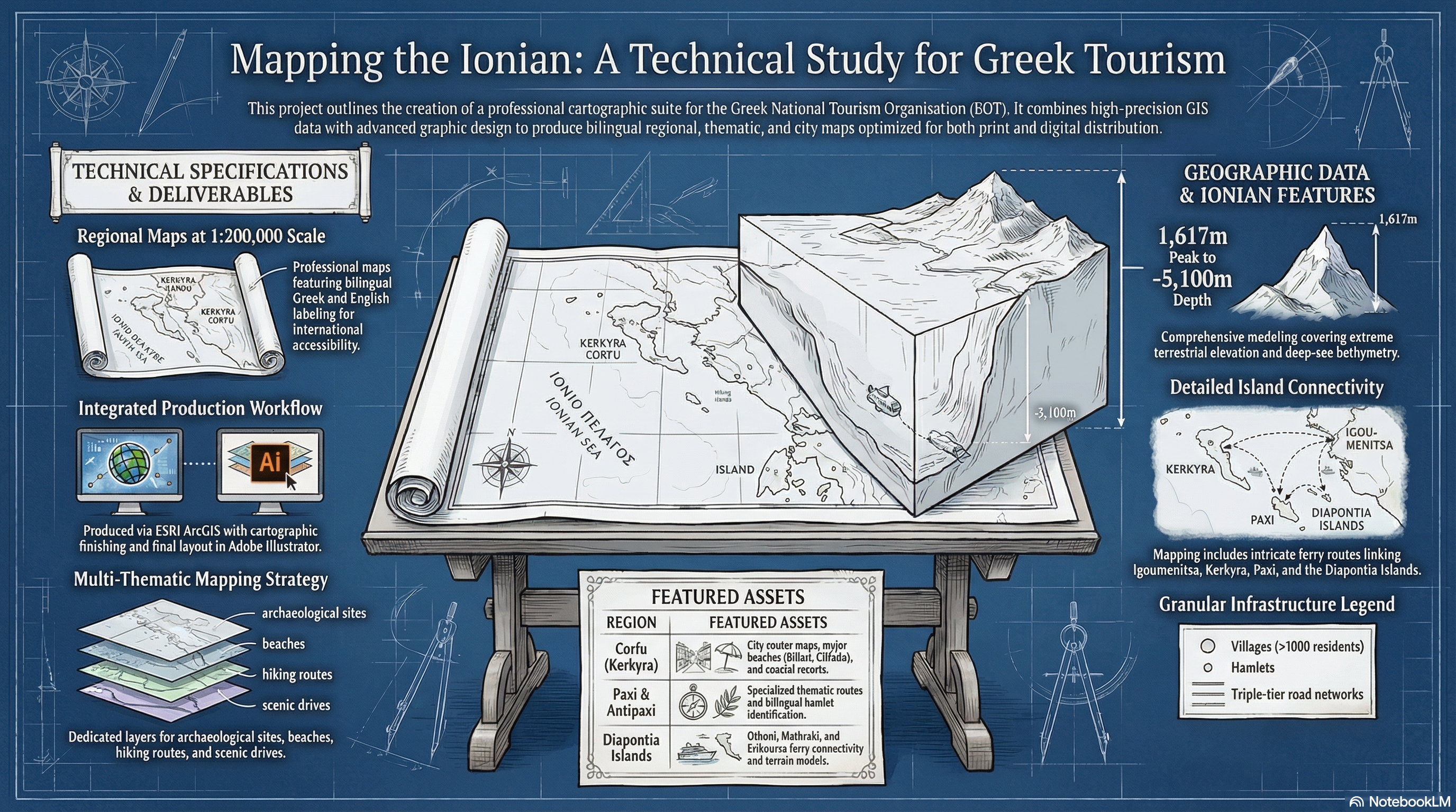
EOT Tourist Maps
Private SectorEratosthenes S.A., Athens · 2008–2010
High-quality cartographic products produced for the Greek National Tourism Organisation (EOT), including regional tourist maps and thematic atlases.
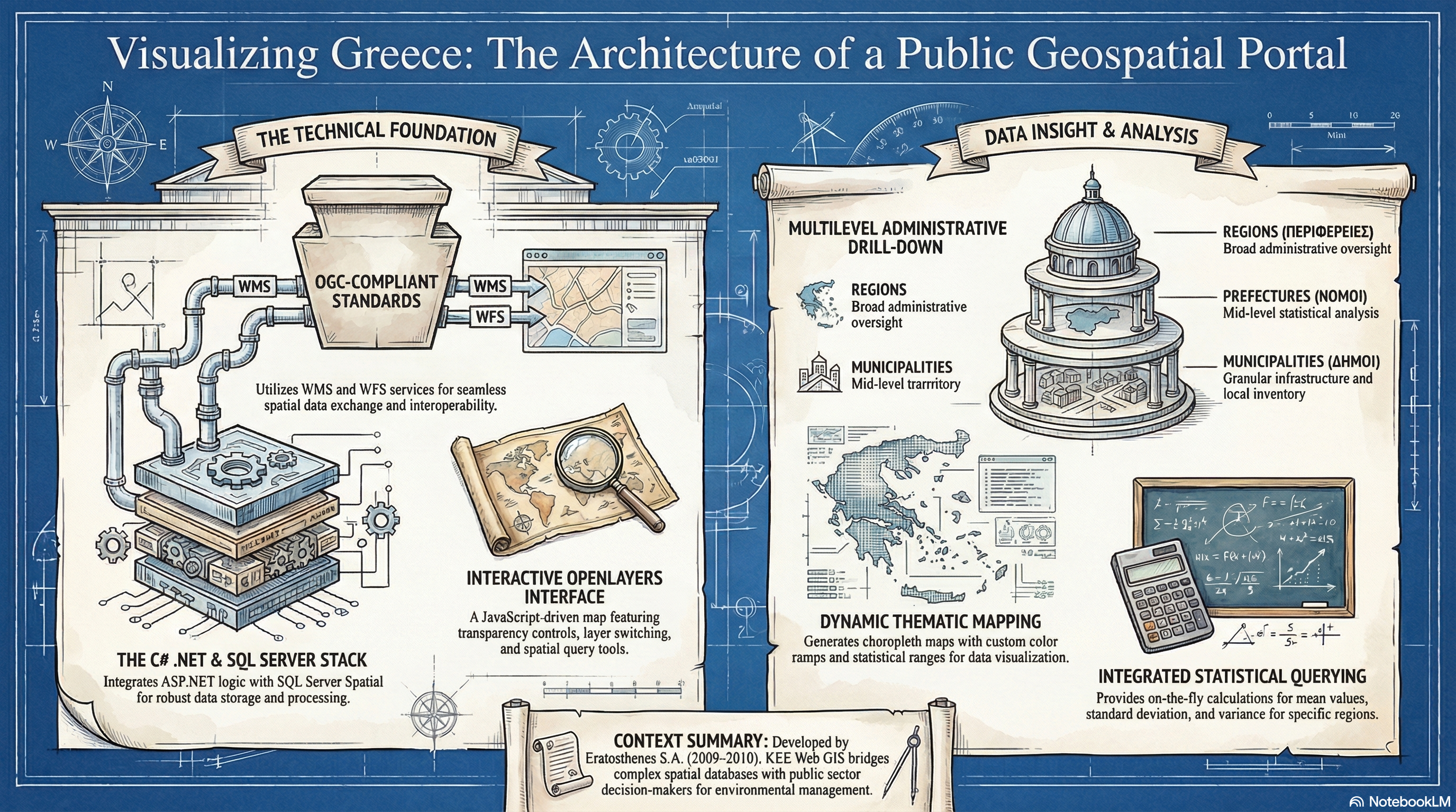
KEE Web GIS
Private SectorEratosthenes S.A., Athens · 2009–2010
A web-based GIS platform for spatial data publication and querying, developed for Greek government and public sector clients.
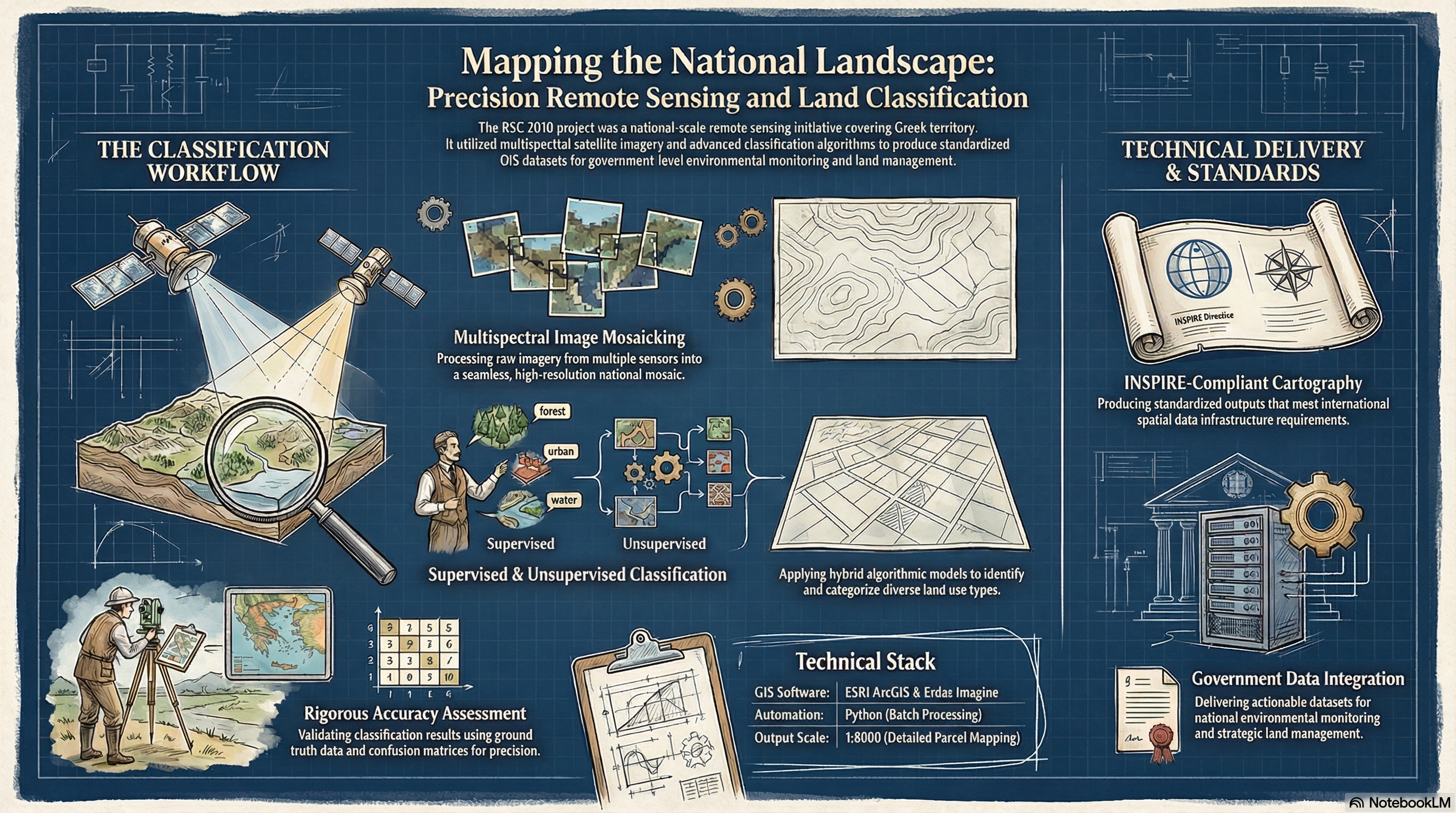
RSC 2010 — Remote Sensing Classification
Private SectorEratosthenes S.A., Athens · 2010
Large-scale land use / land cover classification of Greek territory using multispectral satellite imagery and GIS-based accuracy assessment.
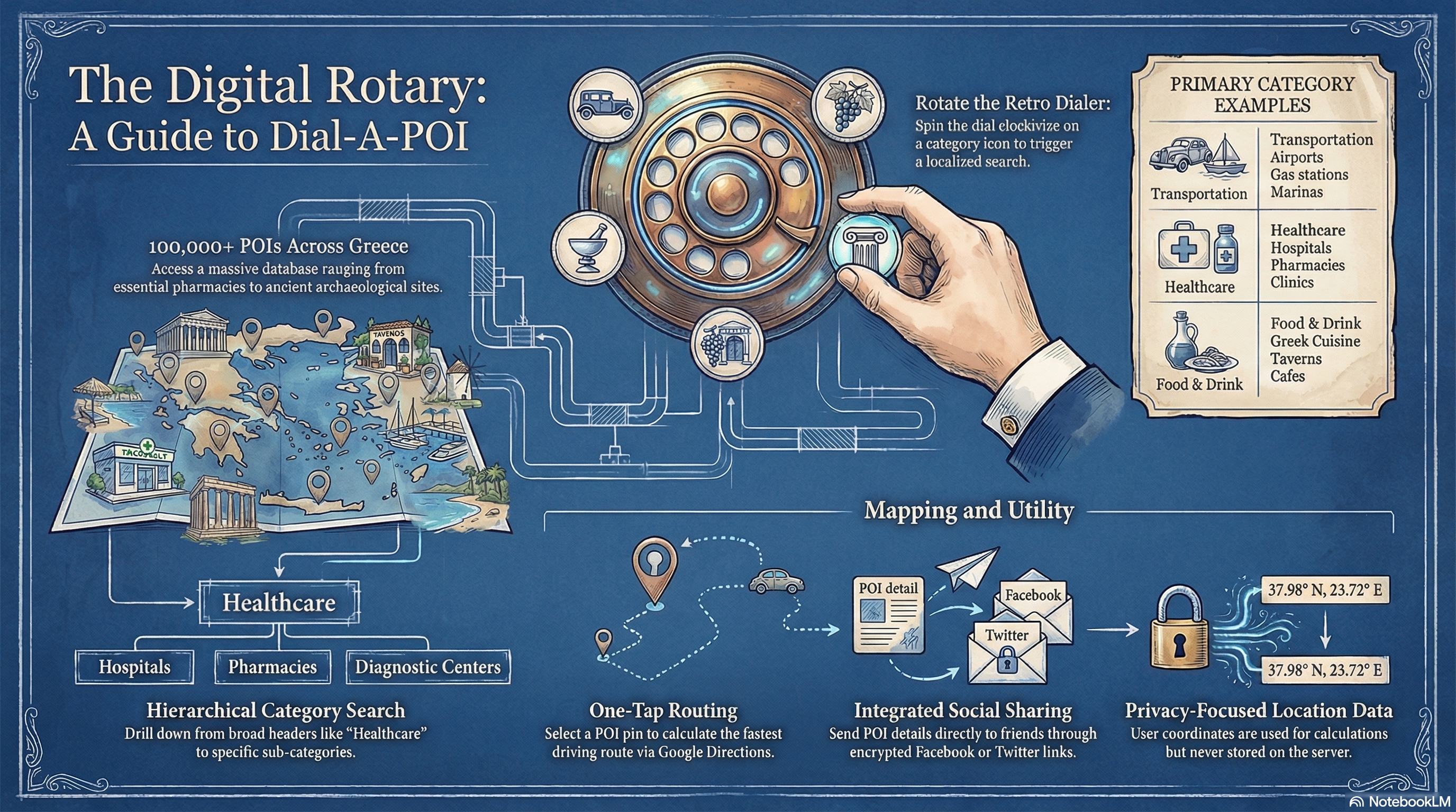
Dial-A-POI
Private SectorEratosthenes S.A., Athens · 2008–2009
A location-based Points of Interest (POI) information system enabling users to retrieve nearby services via mobile and web interfaces.
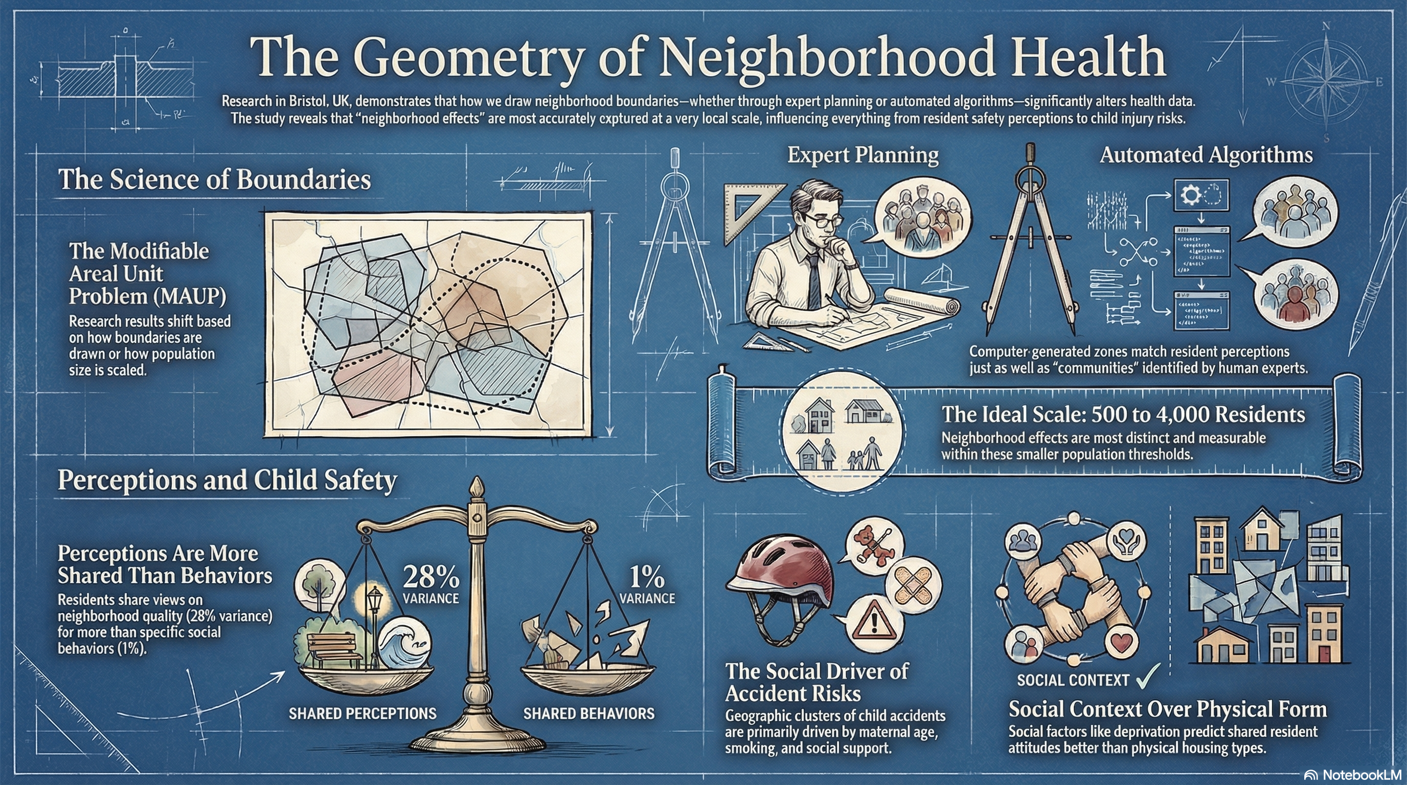
Neighbourhoods and Preschool Injuries
AcademiaUniversity of East Anglia · 2005–2006
Multilevel analysis of neighbourhood and household influences on unintentional injuries in preschool children across 14,000+ children in the UK.
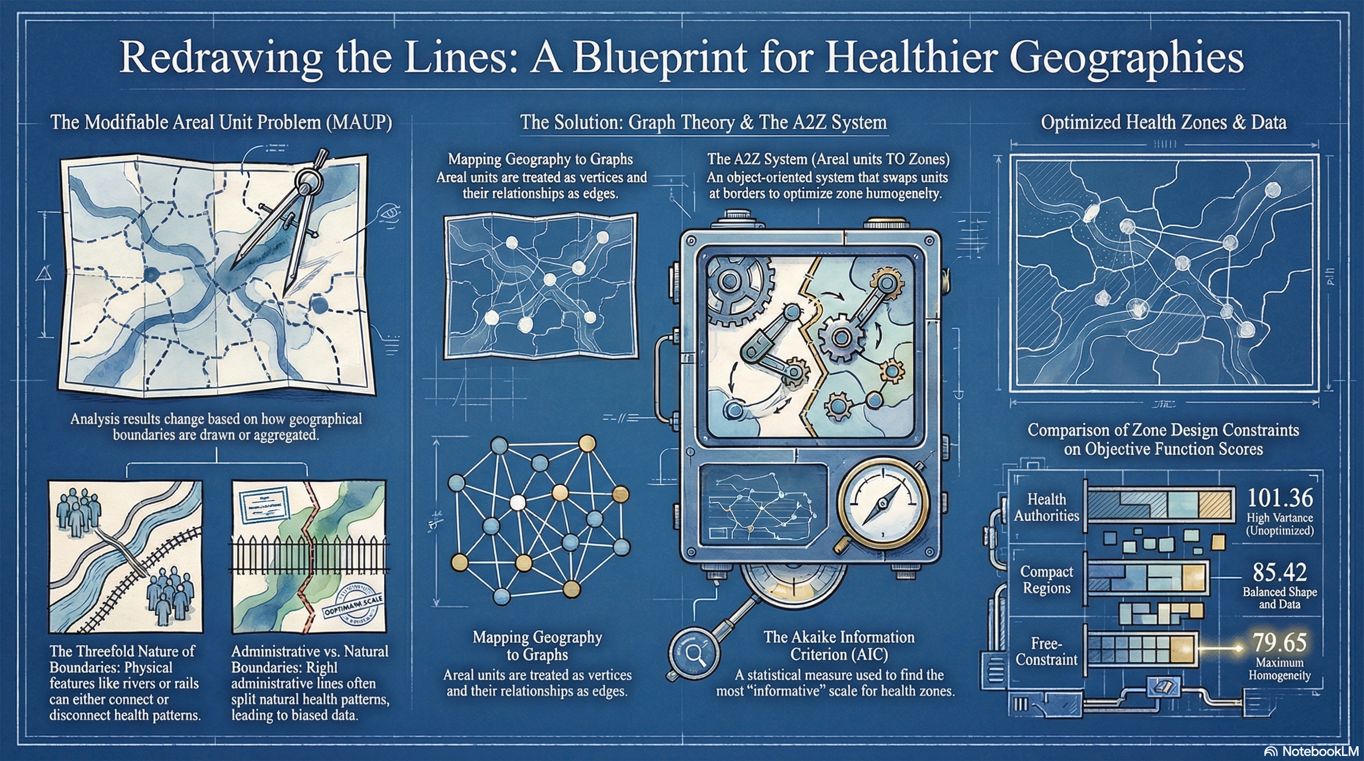
PhD Thesis — Zone Design in Geography of Health
AcademiaUniversity of Newcastle Upon Tyne · 2001–2006
An information statistics approach to Zone Design in the Geography of Health: outcomes and provision. Research on optimal spatial aggregation for healthcare analysis.
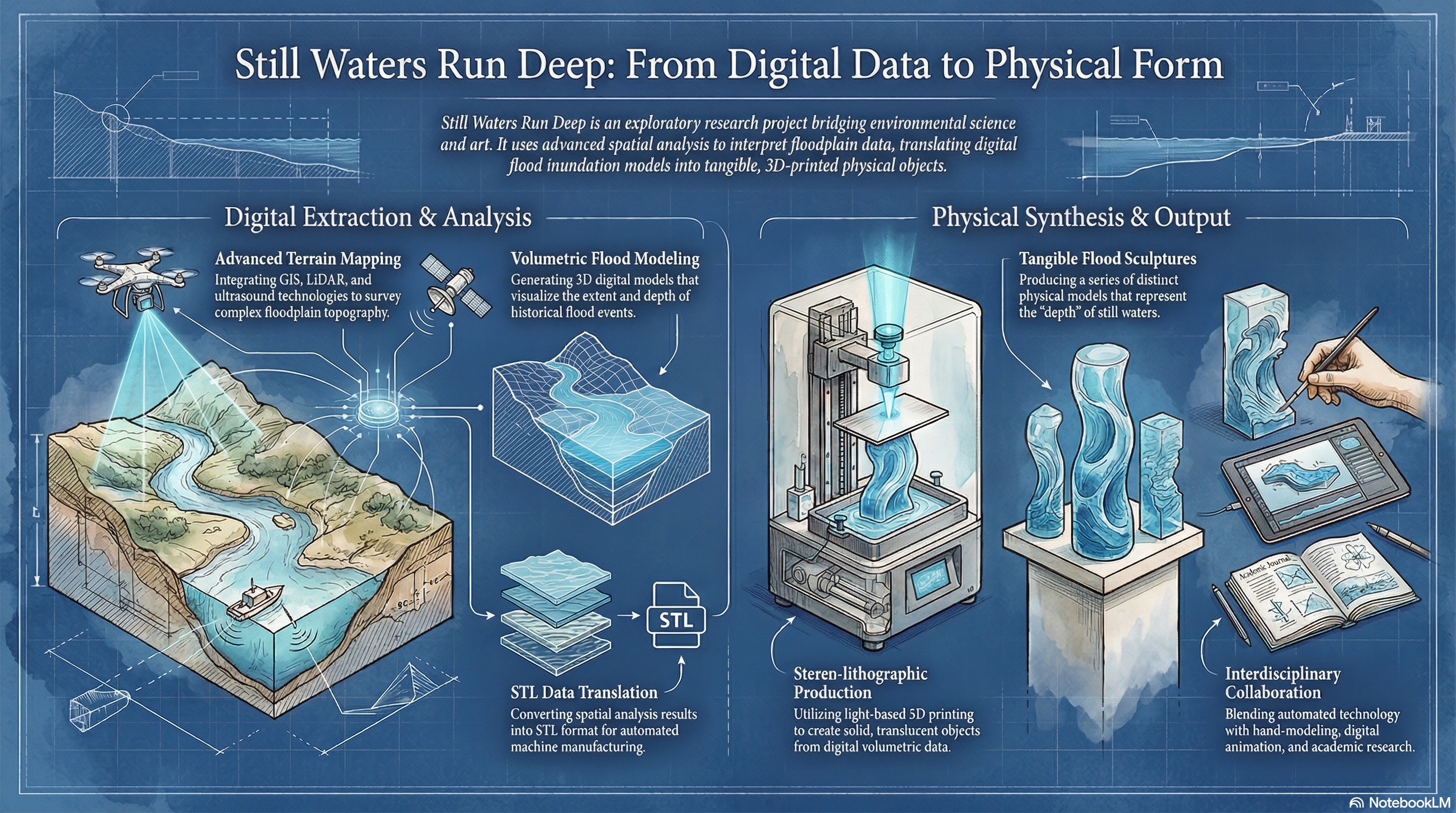
Still Waters Run Deep
AcademiaUniversity of Newcastle Upon Tyne · 2003
Visualisation and spatial experience of flooding events. An exploratory GIS-based project examining the spatial dimensions of flood risk.
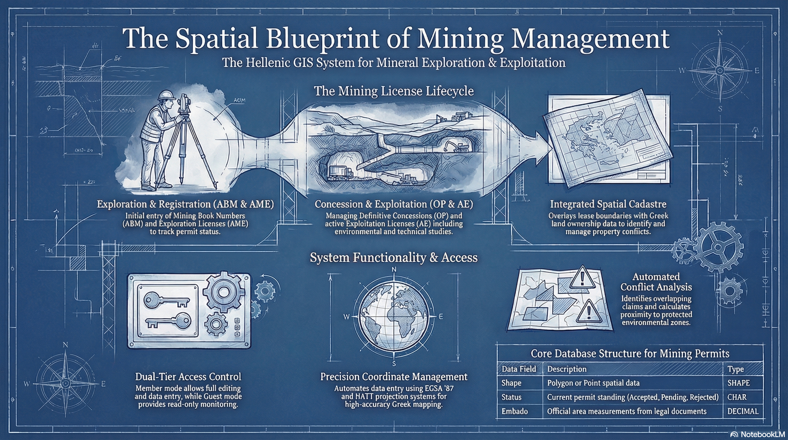
GIS Mining Leasing System
Private SectorPrivate Sector — Greece · 1999–2001
GIS system for the management of silver and baryte ore mining leases in northern Greece, integrating geological, administrative, and legal spatial data.
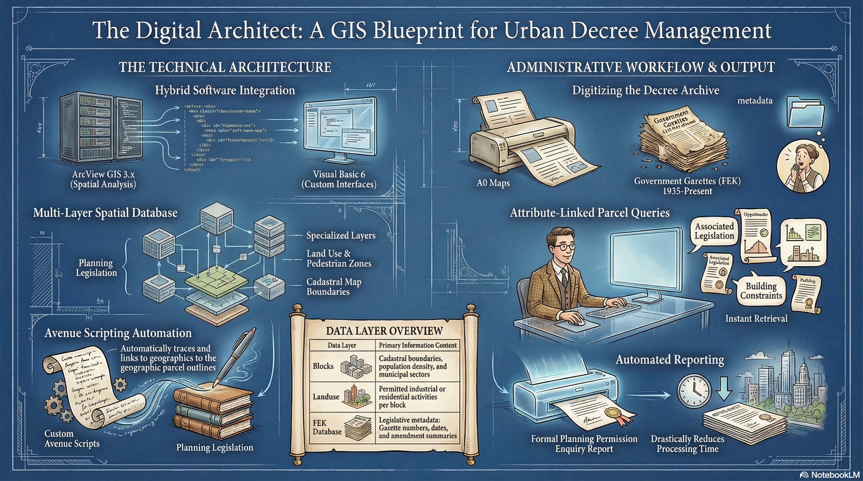
B.Sc. Dissertation — Urban Decrees GIS
AcademiaTEI of Athens · 1999–2000
Dynamic management of Urban Decrees in the Municipality of Aigaleo using ArcView GIS and Visual Basic. A desktop GIS application for urban planning administration.
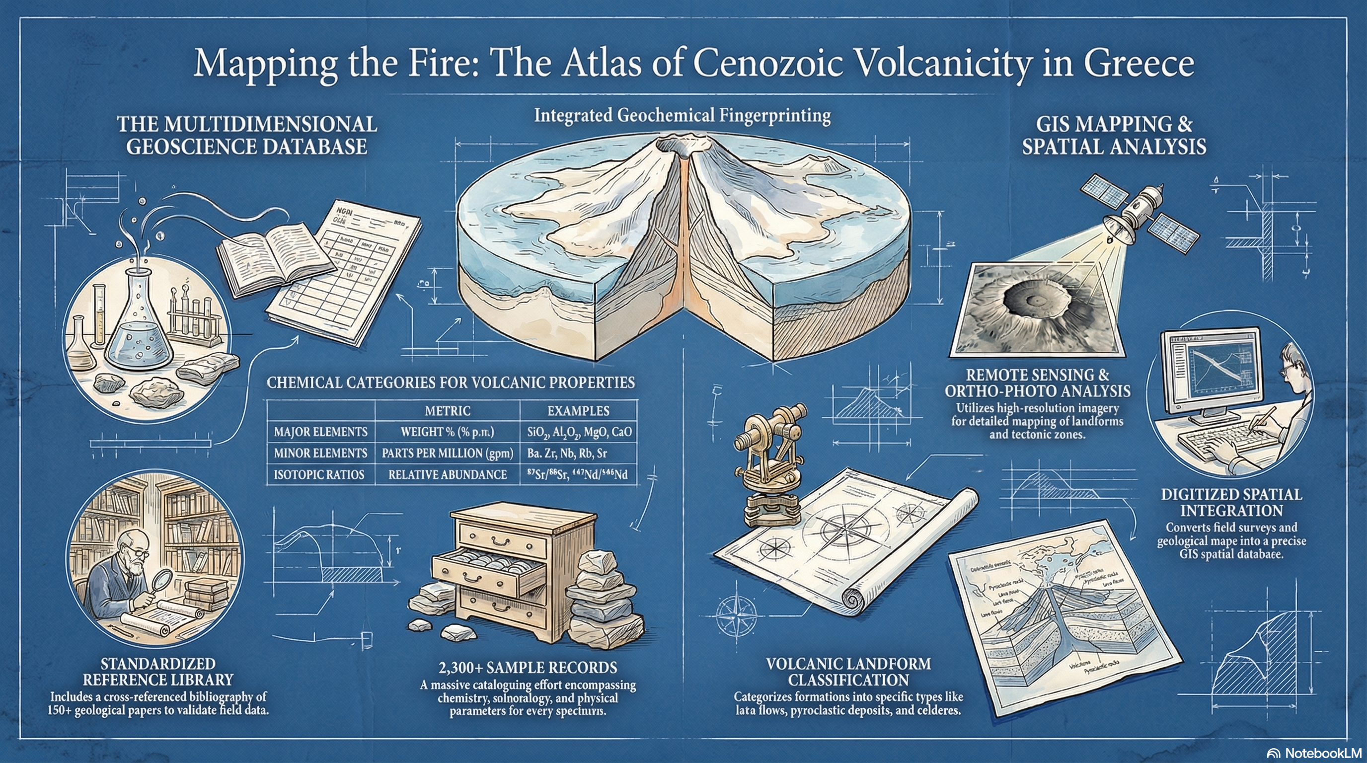
Volcanic Cenozoic Atlas of Greece
Private SectorE.N.B. Ltd / Research Project · 1999–2000
GIS database and cartographic atlas of Cenozoic volcanic formations across Greece, combining geological survey data with remote sensing and field observations.